iPhone Mapping Kit
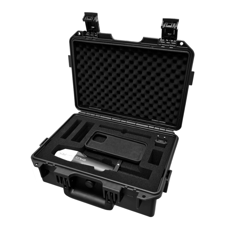


Package Includes:
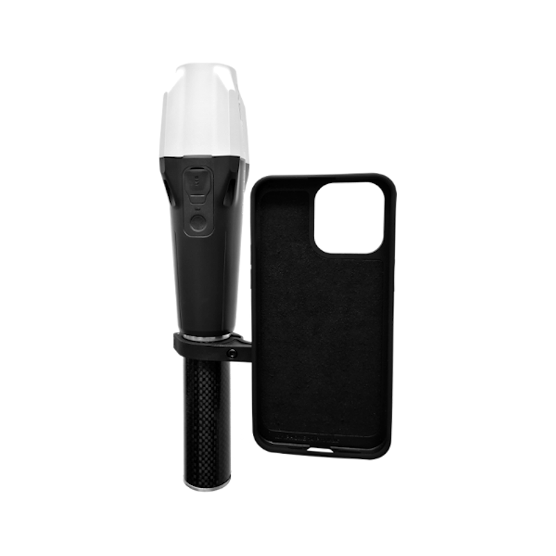
- 1x Emlid Reach RX
- 1x Carbon extention pole
- 1x iPhone 14/15 Pro/proMax holder with SPconnect standart case (For another case get in touch with us!)
- 1x Perpetual licence of GeoAce/ScanAce* (GeoAce/ScanAce software works with all iPhone Pro models after iPhone 12 Pro!)
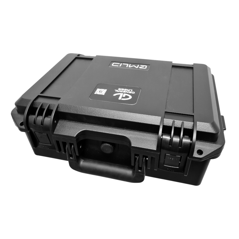
- 1x Rugged case
- 1x Power charger (Type C & Type A)
- 1x USB Type-C cable
* if not excluded from your purchase
If you are purchasing from outside of the DACH region, please contact us under
Specifications
EMLID Reach RX RTK Receiver
Pocket-sized and lightweight |
|
The weight of Reach RX is just 250 grams. Take it anywhere—it weighs less than a can of soda and fits in any glove compartment or a backpack pocket. |
Centimeter accurate data |
|
Reach RX tracks GPS/QZSS, Galileo, GLONASS, and BeiDou and gets a fix in under 5 seconds even in challenging conditions. |
Anyone on the team can use RTK |
|
Reach RX is designed to meet the expectations of both experienced professionals and non-surveyors who need to get highly-accurate results. No training is required. |
GeoAce Software
GeoAce
|
|
GeoAce turns your smartphone or tablet into a precise, centimeter-accurate surveying system, without the need to use GNSS receivers or total stations.
It uses Visual SLAM positioning and Augmented Reality technology to accurately determine the position of your smartphone/tablet in space and collect 3-dimensional data at the same time directly in the video stream. It doesn’t rely on GNSS positioning, so it can be used also indoors, under tree coverage and even in underground mining. You can connect external GNSS receivers to further increase the versatility of the application.
Features:
|
Precise Surveying
|
|
GeoAce is ideal for digital construction documentation, surveys, area measurements, billing in civil engineering, measuring house connections or for planning tasks. New objects are simply measured directly in the video image of the smartphone or tablet. Additional hardware such as expensive GNSS receivers, total stations or laser range finders are not required.
The GeoAce app was specially developed for civil engineering companies, garden and landscape designers and fitters. This means that recording and documentation can take place immediately after installation, and specially trained surveyors no longer must be called to the construction site. This saves you valuable time and money and ensures that the documentation is done efficiently. |
Augmented Reality
|
|
Through the combination of GNSS, inertial technology and photogrammetry, objects can be captured not only traditionally with an antenna pole, but also directly with the cross hairs in the video image. That means that you can measure building corners, pipe objects in a trench or manhole covers on a busy road from a safe distance of up to 10 meters away, precisely and without additional tools.
In situations where satellite reception is no longer sufficient for centimetre-precise positions (e.g. under trees, in the forest, in underpasses, etc.), the Augmented Reality GNSS rover automatically switches to the combined inertial/photogrammetry solution and still allows a precise measurement - and all without GNSS.
Depending on the smartphone or tablet used, you can bridge distances of 100 m and more without any GNSS reception at all. A total station or other aids are no longer required. |
 Reach RS2+ Survey Kit
Two Reach RS2+ receivers for surveying in RTK and PPK modes. Centimeter accuracy for surveying, mapping and data collection.
 Emlid Reach RS2+
Multi-band RTK GNSS receiver with centimeter precision for surveying, mapping and navigation. Comes with a mobile app.
 Reach M2 UAV Mapping Kit+
Emlid Reach M2 as air module and Emlid Reach RS2+ as base station. For precise UAV mapping applications. Comes with a mobile app.
 Reach M2 UAV RTK Kit+
Upgrade GPS in your drone with centimeter-accurate Reach M2 UAV RTK kit. Reach M2 receives corrections from Reach RS2+ using LoRa radio and outputs precise coordinates to the autopilot. This kit can also be used in other applications, where moving receiver needs to be compact.
 ScanAce
ScanAce is a professional 3D scanning app for surveyors, construction and utility workers, archaeologists, architects, and GIS professionals.
 Pole Emlid Hold
Emlid Teleskoppol aus Aluminium 1,80 m für Reach RS2/RS+ mit Handyhalterung
 Pole Triangl
Triangl telescopic carbon surveying pole 2.45m with 5/8" male thread
 GeoAce
GeoAce turns your smartphone or tablet into a precise, centimeter-accurate surveying system, without the need to use GNSS receivers or total stations.


")
")
")