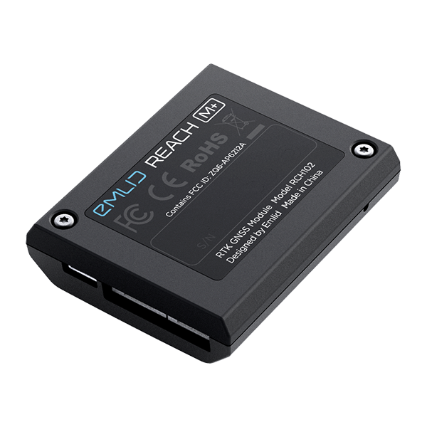
General Laser is the distributor for Emlid products in Europe.
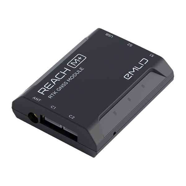
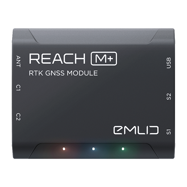
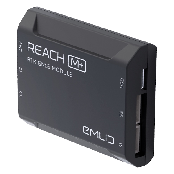
Emlid Reach M+
Single-band RTK GNSS module with centimeter precision for precise navigation and UAV mapping with fewer GCPs. Comes with a mobile app. Baseline up to 10 km in RTK and 20 km in PPK.
Sales price 394,80 €
Sales price without tax 329,00 €
Discount
Tax amount 65,80 €
Price / kg:


Description
Comes
Camera
Simple log
Monitoring
Package Includes:
- 1x Emlid Reach M+
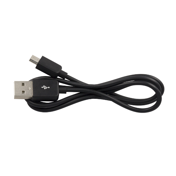
- 1x Charging Cable USB-A to Micro-USB
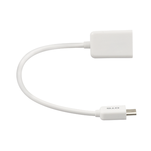
- 1x Cable OTG to Micro-USB
- 1x JST-GH 6-pin to Jumper Pin Cable
- 1x JST-GH 5-pin to Jumper Pin Cable
PPK mapping with centimeter accuracy. Use fewer GCPs
Why camera synchronization is so important
Usually autopilot triggers the camera and records the coordinate it has at that moment. When the drone is flying at 20 m/s and GPS works at 5 Hz, that means your autopilot will have position readings only each 4 m, which is not suitable for precise georeferencing. In addition, there is always a delay between the trigger and the actual moment the photo is taken.
Reach eliminates the delay
Reach solves the problem of positioning by connecting directly to the camera hot shoe port, which is synced with the shutter. The time and coordinates of each photo are logged with a resolution of less than a microsecond. This method allows GCPs to be used only to check your accuracy.
NTRIP or another Reach as a base station
To calculate centimeter-precise coordinates in PPK and RTK, Reach needs corrections from a base station. It could be either another Reach receiver or an NTRIP service. VRS is also supported.
Compatibility
Reach M2 and M+ work seamlessly with other Reach receivers over any link and are compatible with any other receiver that supports RTCM3 and NTRIP.
Reach M+
If you work within short baselines, then Reach M+ is an optimal choice.
RTK
Up to 10 km
PPK
Up to 20 km
Time to fix
1-2 min
Frequency bands
Single-band
RINEX logging update rate
Up to 14 Hz
Comes
with ReachView 3 app
The most user-friendly software for data collection that is available both for Android and iOS. Supports thousands of coordinate systems and is translated into multiple languages. With ReachView 3, you can control all the features of Reach receivers, such as setting up a base station, logging RINEX data, and configuring NMEA output.
Camera
control
Reach can trigger cameras as well as register events. The event mark feature is a must for aerial mapping as it allows the precise time when the shutter was activated to be registered.
Simple log
management
Logs are automatically recorded directly to RINEX in the internal memory. View a list of the logs and download them using the ReachView app.
Monitoring
data
ReachView shows current satellite levels, your location on a map, and much more.
Specifications
Mechanical |
|
|
Dimensions |
56.4 x 45.3 x 14.6 mm |
|
Weight |
35 g |
|
Operating tº |
-20…+65 ºC |
Electrical |
|
|
Input voltage on USB and JST GH |
4.75 - 5.5 V |
|
Antenna DC bias |
3.3 V |
|
Avg. consumption @5V |
200 mA |
Positioning |
|
|
Static horizontal |
5 mm + 1 ppm |
|
Static vertical |
10 mm + 2 ppm |
|
Kinematic horizontal |
7 mm + 1 ppm |
|
Kinematic vertical |
14 mm + 2 ppm |
Connectivity |
|
|
LoRa radio (sold separately) |
|
|
Frequency range |
868/915 MHz |
|
Distance |
Up to 8 km |
|
Wi-Fi |
802.11b/g/n |
|
Bluetooth |
4.0/2.1 EDR |
|
Ports |
USB, UART, Event |
Data |
|
|
Corrections |
NTRIP, VRS, RTCM3 |
|
Position output |
NMEA, LLH/XYZ |
|
Data logging |
RINEX with events |
|
Internal storage |
8 GB |
GNSS |
|
|
Signal tracked |
GPS/QZSS L1, GLONASS G1, |
|
Number of channels |
72 |
|
Update rates |
14 Hz / 5 Hz |
|
IMU |
9DOF |
Related Products

 Cable 2m with TNC Connector for Reach M2/M+
Sales price: 22,80 €
Sales price without tax: 19,00 €
Discount:
Tax amount: 3,80 €
Price / kg:
Cable of 2 meters length with a TNC connector on one side and an MCX connector on the other side to connect to an Emlid Reach M2 or Emlid Reach M+ module.
 Extension Cable 2m for Antenna M2/M+
Sales price: 22,80 €
Sales price without tax: 19,00 €
Discount:
Tax amount: 3,80 €
Price / kg:
Cable of 2 meters length with an MCX female connector on one side and an MCX male connector on the other side to connect to an Emlid Reach M2 or Emlid Reach M+ module.
 Cable 0.5m with SMA Connector for Reach M2/M+
Sales price: 22,80 €
Sales price without tax: 19,00 €
Discount:
Tax amount: 3,80 €
Price / kg:
Cable of 0.5 meters length with an SMA connector on one side and an MCX connector on the other side to connect to an Emlid Reach M2 or Emlid Reach M+ module.
 Emlid Reach RS+
Sales price: 1198,80 €
Sales price without tax: 999,00 €
Discount:
Tax amount: 199,80 €
Price / kg:
Single-band RTK GNSS receiver with centimeter precision for surveying, mapping, data collection and precise navigation. Comes with a mobile app. Baseline up to 10 km in RTK and 20 km in PPK.
 Tallysman GNSS Antenna for Reach M+
Sales price: 82,80 €
Sales price without tax: 69,00 €
Discount:
Tax amount: 13,80 €
Price / kg:
Compact wideband GNSS antenna (Accutenna™ technology) that provides accurate reception for all upper L-band GPS, GLONASS, Beidou, and Galileo signals (L1, G1, B1, B1 BOC, B12, E1) and associated augmentation signals (WAAS, EGNOS and MSAS SBAS).
 Emlid Reach RS2+
Sales price: 2638,80 €
Sales price without tax: 2199,00 €
Discount:
Tax amount: 439,80 €
Price / kg:
Multi-band RTK GNSS receiver with centimeter precision for surveying, mapping and navigation. Comes with a mobile app.
")
")
")